Railway Infrastructure monitoring
RANGLO
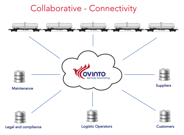
Status date: 23 February 2023This activity aims to deliver a data integration and predictive analytics service for rail freight in the UK. The software platform will help and feed the existing software infrastructure for different users and customers, connecting any relevant internal & external data source to make non-flexible software modules/silos extremely flexible through collaboration, data exchange and integration.
SIM
Status date: 22 February 2023LiveEO provides an innovative infrastructure monitoring for railways, electricity grids and pipelines that identifies vegetation, ground deformation and third-party interactions in order to progress to predictive maintenance and aims at reducing operational expenses by at least 25%.
EO4I
Status date: 08 December 2022The EO4Infrastructure project is conceived as EO application project that aim at developing innovative EO products and methods in response to authoritative end-user requirements and to prepare the ground for a long-term exploitation by large user communities through dedicated down-stream services.
LUCI
Status date: 22 September 2022LUCI’s main objective is to provide adjacent land use change identification over a demonstration part of the UK rail network. By utilising remotely sensed Earth Observation imagery and machine learning models, the project will deliver a change map of the land adjacent to the rail network. The solution delivers change alerts and type of change information to allow users to assess the impact of the change.
SUMO4Rail
Status date: 18 August 2021SUMO4Rail aims at a concise evaluation of the German ground motion service (Boden-Bewegungs Dienst – BBD) deformation products with dedicated consideration of the requirements of the Eisenbahn-Bundesamt (German Federal Railway Authority, Germany – EBA) including the valorization of these deformation products for the EBAs monitoring and decision support system.
DINoS5G
Status date: 18 August 2021DINoS5G project aims to develop an end-to-end platform from integration of High Throughput Satellite (HTS) system and 5G terrestrial infrastructure, enabling communications for an advanced diagnostic service in the railway environment. The platform provides communication interfaces to applications for real-time monitoring and “smart” predictive maintenance services of the railway infrastructure.
LiveLand
Status date: 20 February 2018Transport operators across the UK face significant challenges in monitoring and detecting landslides and subsidence across their networks. LiveLand supports asset owners and operators to assess and monitor high-risk areas of their transport network providing improved geological hazard information at regional, network and local levels using integrated data from Earth observation satellites and GNSS.
RailSAT - Monitoring Railway Track Geometry and its Surroundings Search form Search
Status date: 29 June 2017The objective of the RailSAT project is to assess both the technical feasibility and commercial viability of sustainable operational services that enhance the current practices of monitoring railway track geometry and the surrounding environment by using satellite data. Earth observation, Interferometric Synthetic Aperture Radar (InSAR) and satellite navigation data are used to achieve this objective.
MATIST
Status date: 09 April 2014The MATIST services provide ground motion information to operators of alpine transportation infrastructures such as railway companies, institutes representing the national roads and companies from the energy sector.
SPACE FOR RAIL PRIZE
Status date: 10 February 2014This prize competition seeks outline proposals to develop solutions for the UK rail industry, involving the integration of two or more satellite-based systems (communications, navigation and remote sensing) with conventional (non-space) ones.
Live Land
Status date: 29 November 2013The objective of Live Land is to provide users with a suite of services that enables the management of hazards and the exposure of national transport infrastructure assets to landslide and subsidence events. During the feasibility stage, the Live Land consortium assessed the viability of developing a suite of services driven by the needs and requirements of end user organisations. Live Land proposed a ‘catalogue’ concept, to incorporate a suite of enabling technologies (including Space-borne, in-situ and geological datasets) that could improve the forecasting, monitoring and alerting of landslides and subsidence.


